Researchers tasked with protecting our environment are implementing new cameras that help organizations identify invasive species quickly. The unchecked growth of weeds – many of which look attractive – can cause widespread damage to ecosystems. Cameras with customized lenses make identification easier.
Remote Sensing Lenses To The Rescue
Researchers can now take pictures of plants and compare them with images in a database to confirm their identity. This allows them to quickly and efficiently snap pictures of the plants and compare them with images stored in a database.
This camera technology not only helps weed teams to do their job more efficiently, it also provides valuable data that they can use to track the spreading of invasive species. Organizations can target resources more effectively by keeping track of the locations and times they discover these plants. Remote Sensing Lenses also allow for greater research precision and depth.
Remote Sensing Lenses Boost Invasive Species Research
How It Works
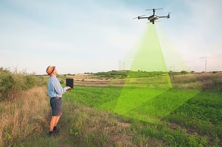
Information gathering involves taking pictures of the earth from a higher perspective, like from space or from an aircraft. The team uses airborne or satellite cameras that can capture data in the thermal and far-infrared spectrums of light.
Satellite data with very high resolution has been available in recent years. The imaging can detect objects as small a millimeter, and it is more precise in identifying plants because the images are captured at specific wavelengths of electromagnetic spectrum.
Researchers are revolutionized by the advances in cameras, optical lenses and other technologies. Researchers now have sufficient data to better understand the spread of species and how to prevent catastrophic invasions.
Stopping Aggressive Invaders
Some invasive species outgrow local vegetation so fast that they completely replace it, which can permanently harm the ecosystem. Field ecologists can organize their work better by identifying the unique signatures of invader plants.
Researchers can use the standardized differences vegetation index (NDVI), which is derived from data collected during the spring and autumn, to determine what is growing and at what rate. Satellite mapping also adds to the existing knowledge. Satellite images can be used to identify seasonal (phenological) variations, structural elements and physiological events.
Core technology enhances the current understanding about ecosystems, and how they can change when new species arrive. Remote sensing is a hot subject since 2010. Remote Sensing is now at the forefront of research to help achieve biodiversity.
Once established, some invasive species can be very difficult to eradicate. It is for this reason that preventing their spread is a more desirable goal and a primary objective of field ecologists. The technology is keeping up with their ambitions.


